THE ‘RIT’ STUFF TO IDENTIFY WATER STORAGE SITES
- WWLA

- Feb 2, 2020
- 2 min read
A new locally developed automated Reservoir Identification Tool, or RIT, is being utilised by councils, farmers and growers to help identify potential storage locations.
The tool, developed by Williamson Water and Land Advisory, has been invaluable in helping identify hundreds of potential storage locations at both property, and wider community level within Northland.
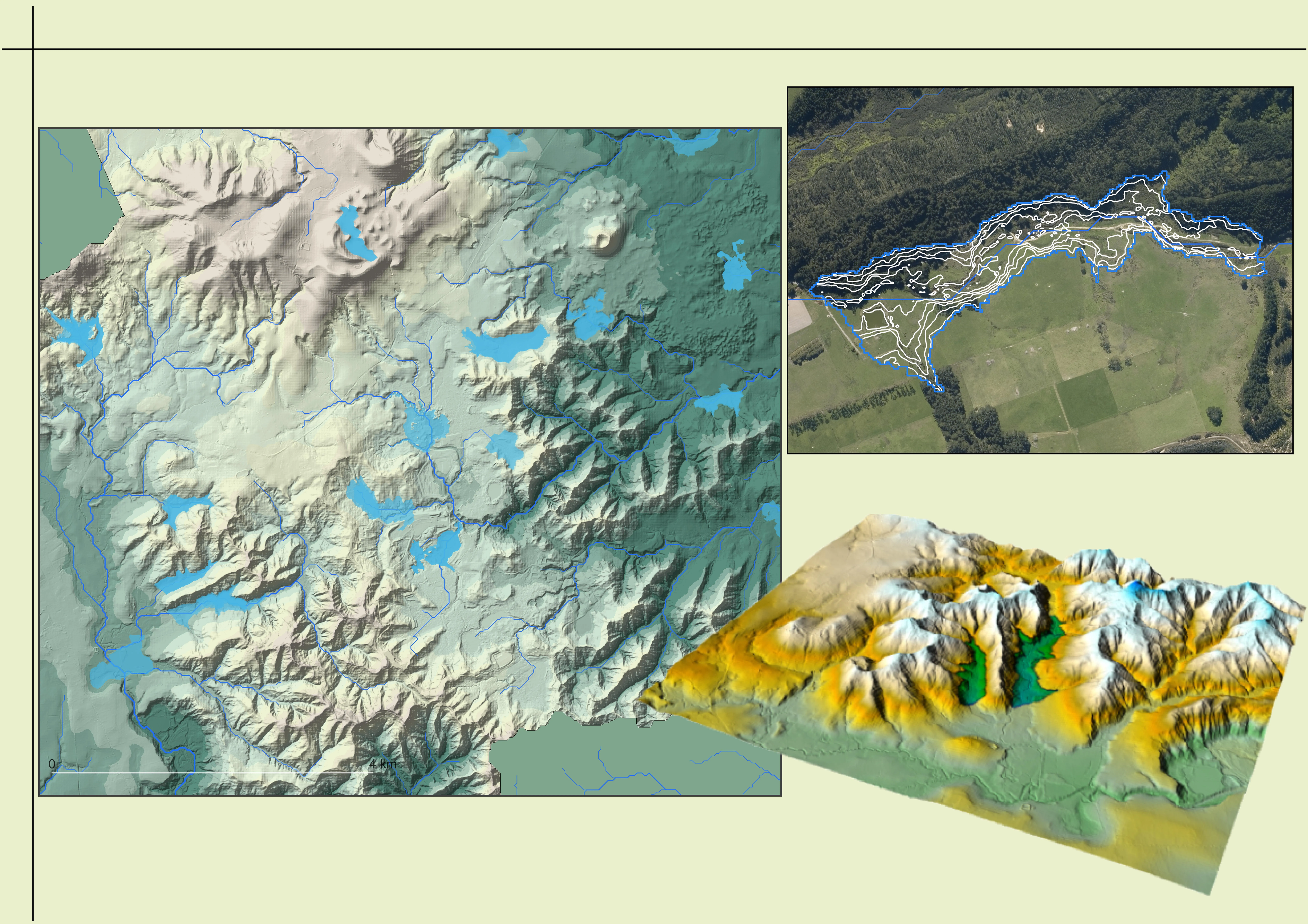
Initial storage locations, identified across geotechnical and cost considerations, are then refined using other parameters - including environmental and cultural values.
It has allowed a long list of preferential sites to be easily created based upon geotechnical and construction cost considerations, with the list then further refined using multi-criteria analysis that considers (amongst other things) cultural and environmental values.
WWLA managing director Jon Williamson said the system used sophisticated analysis on high resolution digital elevation models, or DEMs, to quickly identify potential impoundment sites in topographic depressions.
“One of the system’s advantages is its rapid processing, with the ability to identify potential reservoir sites over large areas in a matter of minutes.”
Key features of the system include:
● User definable reservoir criteria for the particular project in mind, including:
○ Minimum and maximum reservoir storage size.
○ Maximum embankment wall length and height.
● Graphical GIS based outputs of storage reservoir footprints (surface area).
● Tabulated metadata calculated for all identified sites, including:
○ Storage volume and surface area.
○ Embankment wall length, height, and fill volume.
○ Storage efficiency (storage volume / embankment fill volume).
● Identified reservoirs ranked based on user defined criteria including any of the associated metadata e.g. storage size or embankment efficiency.
● The ability to exclude areas of significance, for example conservation land, wetlands or native bush and large existing infrastructure, including roads and transmission lines.
RIT provides a critical tool for central and local government, farmers and growers, to make sound infrastructure investment decisions associated with the productive use of land, management of water, and to mitigate the impacts of climate change.


Comments